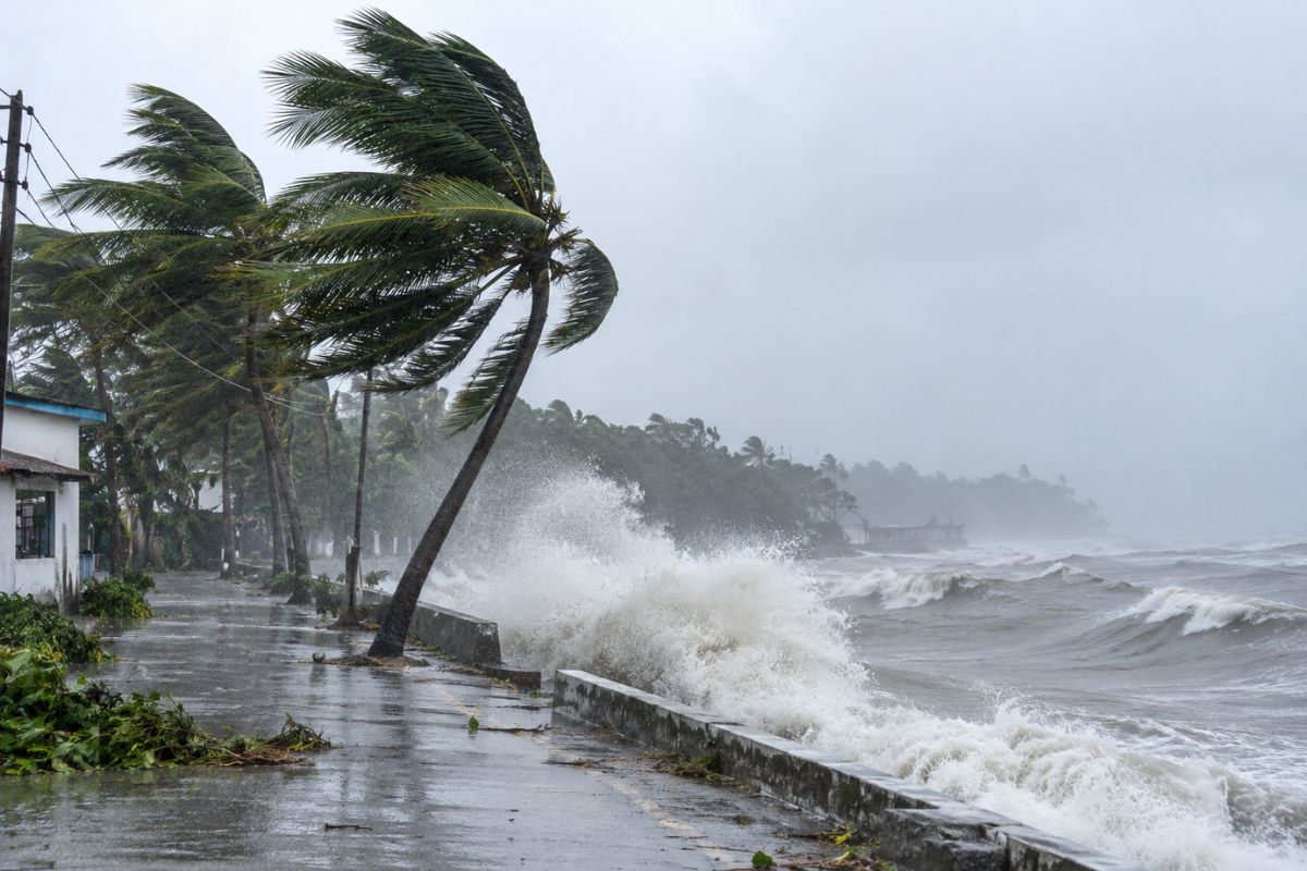
Cyclone Akvan is brewing over the Bay of Bengal right now. Honestly, it has put India’s entire eastern coast on high alert. The India Meteorological Department (IMD) expects it to grow much stronger soon. It should turn into a very severe cyclonic storm before hitting Andhra Pradesh. Landfall will likely happen around 20 November 2026. Let’s look at where it is heading and what you must do.
- Current location: It sits over the central and west-central Bay of Bengal.
- Latest reported position: Forecasters spotted it at 12.2°N latitude and 85.7°E longitude.
- Expected landfall: It will cross the Andhra Pradesh coast between Nellore and Tuni.
- Forecast wind speed: Winds will reach 120–130 km/h, and gusts could reach 145 km/h.
- Main concerns: Expect heavy rain, fierce winds, rough seas, and nasty coastal flooding.
What Is Cyclone Akvan and Where Is It Now?
Cyclone Akvan started as a deep depression over the warm Bay of Bengal. It gained strength and became an official cyclonic storm on 16 November 2026. That happened right around 5:30 pm IST, according to IMD records.
The IMD shared a fresh update on 17 November. They tracked the storm near 12.2°N latitude and 85.7°E longitude. That puts it roughly 610 km east of Chennai. It is also 660 km southeast of Machilipatnam and 670 km south-southeast of Visakhapatnam.
Right now, the system is creeping along in a north-northwesterly direction. Moving at just 10 to 12 km/h, it is taking its sweet time. You know, slow storms are tricky because they dump way more rain. Still, weather tracks shift fast. Do not rely on just one forecast—keep checking live updates.
Also Read: Major US Banks Outage: What Happened And What Caused This Disruption?
Cyclone Akvan Latest Update: Expected Track and Landfall
Forecasters think Akvan will push northwest over the west-central Bay of Bengal. As it travels over warm waters, it will pack a bigger punch.
The 17 November bulletin shows it becoming a severe storm by evening. By the morning of 19 November, it will turn into a very severe storm. Sea surface temperatures around 29°C are feeding this rapid growth.
Landfall should happen along the Andhra Pradesh and Yanam coast. Look for it to cross between Nellore and Tuni around noon on 20 November 2026.
Here are the core numbers from the weather office:
| Weather parameter | IMD forecast |
|---|---|
| Current system | Cyclonic Storm Akvan |
| Current location | 12.2°N, 85.7°E |
| Movement | North-northwestward (10–12 km/h) |
| Severe storm stage | Around the evening of 17 November |
| Very severe storm stage | Around the morning of 19 November |
| Expected landfall | Between Nellore and Tuni |
| Expected landfall date | 20 November 2026 (Noon) |
| Sustained wind speed | 120–130 km/h |
| Maximum wind gusts | Up to 145 km/h |
Source: India Meteorological Department, Press Release dated 17 November 2026. Remember, these are early projections, not final landfall numbers.
Let’s be real: storm paths are never set in stone. A tiny wobble in the ocean can change everything. Even a 50 km shift decides which towns get the worst battering.
Which Areas Are Likely to Be Affected by Cyclone Akvan?
Andhra Pradesh is sitting right in the crosshairs of this system. Yet, huge storms do not care about state borders. Neighbours will feel the heat—or rather, the rain—too.
Folks living between Nellore and Tuni need to stay glued to local alerts. Nearby districts will also get hammered by fierce gusts and downpours.
Odisha cannot let its guard down either. Southern coastal belts face rough surf and heavy rain bands. Tamil Nadu, including Chennai, will likely catch some heavy showers as well.
The IMD’s 17 November release lays out the rain risks clearly:
- Coastal Andhra Pradesh and Yanam: Heavy to very heavy rain hits on 19–20 November. Some spots might see over 20 cm of rain in a single day.
- Telangana: Expect heavy to very heavy downpours on 20 and 21 November.
- Tamil Nadu, Puducherry and Karaikal: Thunderstorms and rain are likely, with heavy spells in a few spots.
- Odisha: Southern districts should brace for heavy rain as the storm nears land.
Low-lying neighbourhoods face the biggest headache here. When drains choke up, waterlogging turns streets into rivers within hours.
Historical Comparison: November Storms on the East Coast
November is peak season for Bay of Bengal cyclones. Here is how Akvan stacks up against recent storms in the region:
| Cyclone Name | Year | Landfall Region | Peak Wind Speed |
|---|---|---|---|
| Cyclone Nivar | 2020 | Puducherry / Tamil Nadu | 120–130 km/h |
| Cyclone Michaung | 2023 | Bapatla, Andhra Pradesh | 90–100 km/h |
| Cyclone Akvan (Forecast) | 2026 | Nellore–Tuni, Andhra Pradesh | 120–130 km/h |
How Strong Will Cyclone Akvan Become?
Wind speed is the biggest worry with Akvan right now. Nobody wants to face a category-equivalent severe storm unprepared.
The IMD thinks winds will hit 120–130 km/h before landfall. Brief gusts could spike all the way up to 145 km/h. That is fast enough to tear off tin roofs.
People often mix up sustained winds and gusts. Sustained wind is the steady speed measured over three minutes. Gusts are sudden, violent bursts that last just a few seconds.
At 130 km/h, weak huts collapse, and big trees snap like twigs. Power lines go down, leaving whole districts in the dark. Standing paddy and banana crops take a brutal beating too.
Of course, ocean heat and wind shear control the final punch. Treat these numbers as a heads-up, not a done deal.
Also Read: Who is Teja Sajja Fiancée?
Why Is Cyclone Akvan Named Akvan?
Weather agencies do not just pull storm names out of a hat. A strict global system keeps track of every big tropical storm.
The World Meteorological Organisation (WMO) oversees names for the North Indian Ocean. Thirteen countries in the region submit lists of names in advance.
Iran gave us the name Akvan for this cycle. It sits on the official roster managed by the WMO/ESCAP Panel.
Giving storms short names makes news reports much clearer. Imagine trying to track two storms at once using only coordinates. That would be a total mess for rescue teams.
You can look up the full WMO cyclone list online anytime.
What Could Be the Possible Impact of Cyclone Akvan?
Fierce winds are only half the story with a storm like Akvan. Storm surges of 1 to 1.5 meters could push seawater inland.
Here is what communities on the ground might deal with:
- Heavy rainfall and flooding: Non-stop rain overwhelms city drains fast. Water rushes into ground-floor homes in low-lying coastal pockets.
- Damage to houses and infrastructure: Thatched roofs blow away, and electric poles topple over. Fallen banyan and neem trees often block main highways for days.
- Disruption to transport: Railways usually cancel coastal trains ahead of landfall. Flights get grounded, and flooded roads strand buses and trucks.
- Agricultural losses: November is harvest time for many farmers. High winds flatten standing crops and ruin stored grain in seconds.
- Dangerous sea conditions: Waves can swell past 4 meters near the eye. Staying off beaches and jetties is plain common sense right now.
Check the IMD district bulletins for exact local warnings. They update wind and rain alerts every three hours.
Safety Measures: How Should People Prepare for Cyclone Akvan?
Waiting until the rain starts is a rookie mistake. Folks in Andhra Pradesh, Odisha, and Tamil Nadu need to act now.
A few simple steps today will save you huge trouble tomorrow:
- Pack clean drinking water, dry snacks, medicines, and a working torch. Put your IDs and land papers in a waterproof plastic bag.
- Charge every phone and power bank to 100% right away. Power cuts can last three to five days after a bad hit.
- Stay far away from beaches, creeks, and flooded underpasses.
- Tie down loose items like flower pots, tin sheets, and signboards. Flying debris causes terrible injuries during peak winds.
- Never take shelter under old trees or live power lines.
- Fishermen must keep their boats anchored and stay ashore.
- Head to government cyclone shelters the moment officials ask you to move.
- Stick to verified updates from the IMD and state disaster teams.
The National Disaster Management Authority (NDMA) shares great checklists online. Read them over with your family tonight.
If you live in a mud house near the sea, leave early. Driving through knee-deep water in 100 km/h winds is a nightmare.
What Is the Latest Official Advisory for Fishermen?
Out at sea, conditions are already turning rough and unpredictable. Gale-force winds are whipping up huge swells across the bay.
The IMD issued a strict ban on fishing trips this week. Small trawlers cannot handle the churning waters ahead of Akvan.
Akashvani News reported a clear warning for all coastal boats. Fishermen must avoid the northwest, southwest, and west-central Bay until 20 November.
Skipping a week of work hurts when fishing pays the bills. Even so, no catch is worth risking your life over. Ports have already hoisted danger signals to warn incoming ships.
Also Read: Raj Shamani Global Record
Final Words
Cyclone Akvan is shaping up to be a serious weather event. With landfall likely between Nellore and Tuni on 20 November, time is short.
Nobody knows the exact damage until the storm actually crosses land. Still, ignoring official warnings never ends well. Skip the wild rumours on WhatsApp and stick to real weather reports.
Grab your supplies, charge your devices, and look out for elderly neighbours. Smart prep right now keeps everyone safe when the winds howl.
FAQs About Cyclone Akvan
- What is Cyclone Akvan?
It is a tropical storm in the Bay of Bengal. Weather officials named it on 16 November 2026. - When will Cyclone Akvan make landfall?
The IMD expects it to cross the coast around noon on 20 November 2026. It should hit between Nellore and Tuni in Andhra Pradesh. - What is the expected wind speed of Cyclone Akvan?
Steady winds will blow at 120–130 km/h. Sudden gusts could spike up to 145 km/h. - Which Indian states could be affected by Cyclone Akvan?
Andhra Pradesh faces the biggest direct hit. Odisha, Tamil Nadu, Puducherry, and Telangana will also get heavy rain. - Who gave the name Cyclone Akvan?
Iran suggested the name Akvan. It comes from the official WMO/ESCAP cyclone list for the North Indian Ocean.